Ayers Rock Resort Precinct Plan
The Ayers Rock Resort is an environmentally, culturally, socially and economically sustainable township managed by Voyages Indigenous Tourism Australia; the Precinct Plan emulates this.
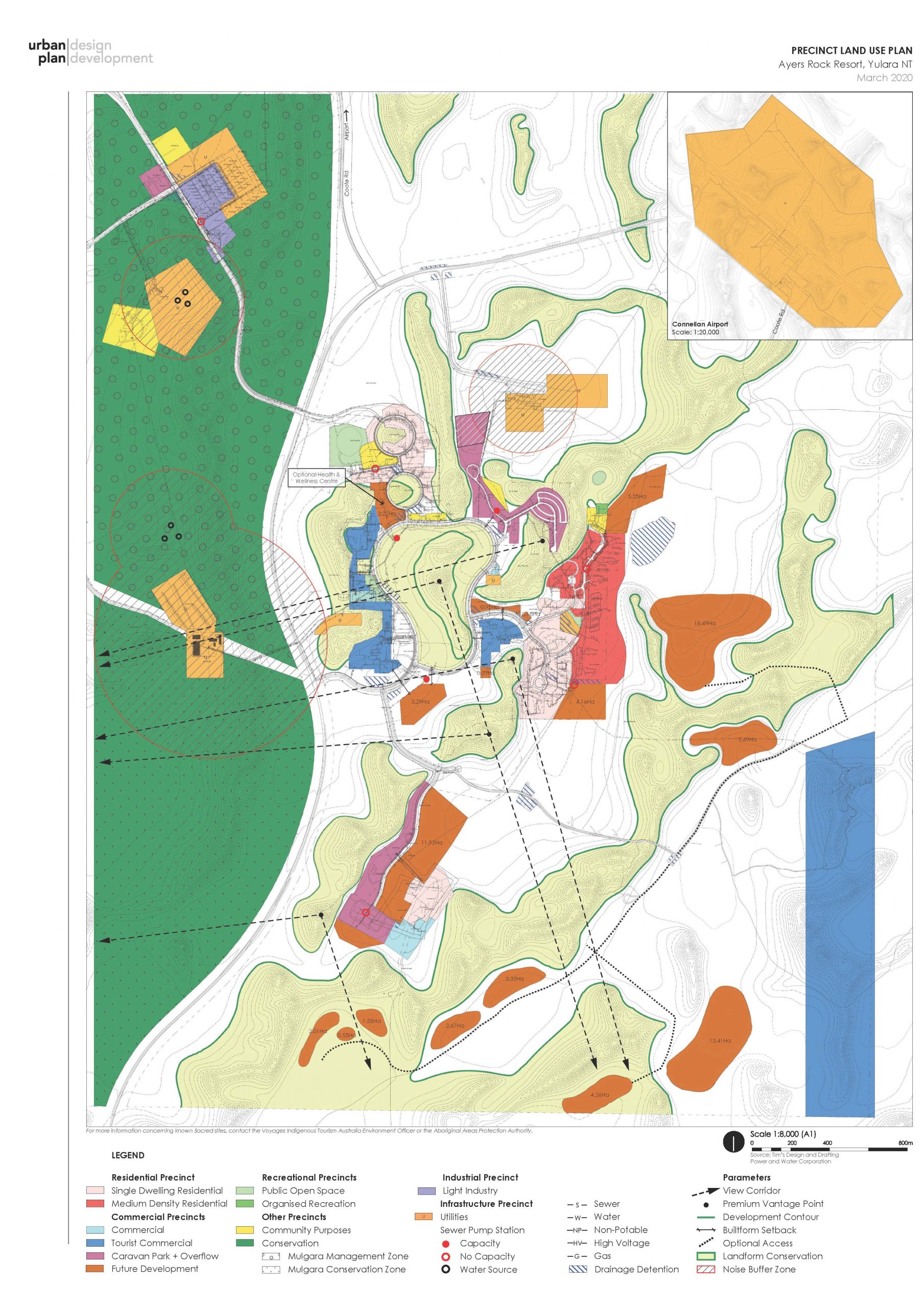
The aim of the Ayers Rock Resort Precinct Plan is to guide appropriate use and development of land at Ayers Rock Resort and surrounds in the context of its natural condition to enable appreciation and enjoyment by the general public and international visitors. Accordingly, it is necessary for proposed development to adopt a siting and design approach that is site responsive to the environment.
In 1982 Cox Architects established the essence of the Ayers Rock Resort development in the desert landscape with an emphasis on siting and design principles that took cues from dunes and dune swales. The original road layout that followed the alignment of the dune swales recognising the dune desert landform is a significant feature. Accordingly a driving principle was the protection of the landform within the Resort as a feature in its own right with the additional function of enabling view corridors to Uluru and Kata Tjuta.
To fulfill the aim of this Precinct Plan namely, to achieve appropriate use and development of land in its sensitive environmental context, siting and design principles were derived from previous Masterplans that commenced as early as 1982:
- Highlighting the expansive desert horizons
- Protecting iconic dunes within the Resort and define as Landform Conservation
- Siting development in a band below the dune Development Contour
- Emphasising view corridors
- Establishing large setbacks to the road
- Situating the road system at the base of the dunal floors.
These are the principles upon which the Ayers Rock Resort Precinct Plan is benchmarked.