Bushfire Analysis
urbanplan provides analytical bushfire assessment and strategic management plan services to facilitate scheme amendments, subdivision and appropriation of development approvals.
In accordance with sustainable land development principles, urbanplan adapts a triple bottom line approach to bushfire assessment to pursue balanced risk based implementation of bushfire management in accordance with SPP 3.7.
In pursuing the policy objectives of SPP 3.7: Planning in Bushfire Prone Areas, namely to apply specific bushfire protection measures to avoid the threat and reduce vulnerability of bushfire risk, urbanplan’s approach to urban bushfire analysis balances management of bushfire risk with environmental protection and conservation of biodiversity values and economic outcomes.
To commence a bushfire assessment, urbanplan describes of the spatial characteristics of the locality to establish the context of the bushfire assessment. This comprises landform and vegetation structure with reference to the Visual Guide for Bushfire Risk Assessment tool and Table 2.4.3 of AS 3959.
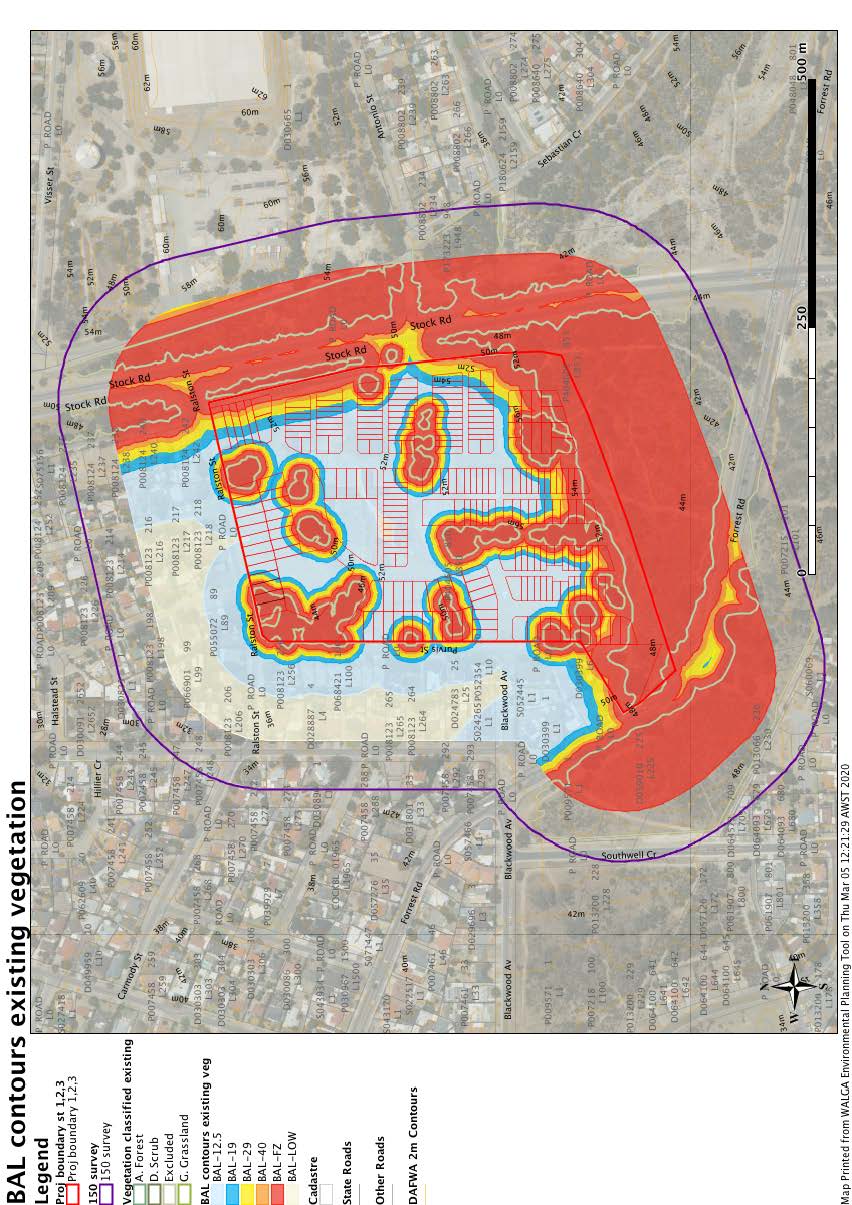
The site specific bushfire assessment requires multiple readings of vegetation classification and describes the separation to and effective slope of each vegetation class to proposed buildings. This includes BAL Site Analysis Map, Vegetation Classification descriptions and BAL Contour Map that assist in the determination of the bushfire attack level. Potential shielding of buildings is addressed. A site specific response is given for each policy objective of SPP 3.7. Items of the Bushfire Protection Criteria are addressed, stipulating the requirement and providing a solution.
To conclude analysis, an approach to bushfire management defines responsibilities for specific management techniques applied to the Bushfire Protection Criteria comprising siting and design within the APZ, noting a gradation of vegetation clusters are permissible, vehicle and emergency access and fire fighting water provision. Specifications of AS 3959 building standards are given in the bushfire management plan at the time of development.
Key Projects include:
- Jindee Residential Estate, stages 2 and 3
- Hamilton Longitude 115 Residential Estate
- Ooraminna Unit Title Scheme Subdivision
- Lake Claremont and Environs
- Beazley Way Group Housing Site
- Service Commercial Zone Cable Beach Road
- South Fremantle Solar Farm
- Lullfitz Drive Tourism Unit accommodation
- Mundaring Shire Jacoby Street Community Buildings
- SAT Advocate for Twin Bridges Subdivision, Boddington